Following the trails of Spanish explorers recalls an earlier pioneer heritage
By Rebecca Chavez-Houck
When Utahns think about pioneer history, they usually imagine religious refugees arriving in wagons or pushing handcarts into what was then Mexican territory in the late 1840s.
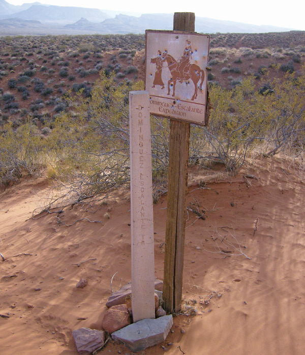
Dominguez-Escalante Expedition trail marker
As a child, however, the history that intrigued me was that of the early Southwestern Spanish explorers. During their 1776 expedition, Franciscan priests Atanasio Dominguez and Silvestre Velez de Escalante traveled through what is today New Mexico, Colorado, Utah and Arizona in search of an overland route from Santa Fe to the Roman Catholic mission in Monterey, Calif. While they didn’t find a route, the maps drawn by their cartographer, Bernardo de Miera y Pacheco, would become invaluable to future pioneers.
The Spanish explorers traversed nearly half of our state, helped in large part by the Timpanogos (Ute) tribe. The names they gave to Utah lands during their exploration of the American West reflected the culture of my own maiden name of Chavez and the primary language of my parents. I love seeing the mural of Dominguez and Escalante in the Utah Capitol rotunda right next to those of Mormon pioneers and fur trappers. As a young schoolgirl, it gave me a sense of cultural belonging, something that often eluded me growing up as a non-Mormon Mexican-American in Utah. These explorers provided me with a sense of patrimonio y historia—heritage and history.
My husband, Martin, and I have already taken our RV to many of the places Dominguez and Escalante scouted in Utah, and we recently traveled through regions of southwestern Colorado that were also mapped by the expedition. The area is easily accessible within a day’s drive from Salt Lake (we consider a day’s drive to be six hours), so it’s well worth going beyond our state borders to see these beautiful places.
We headed south from Salt Lake City and took U.S. Route 6 to Interstate 70 past Green River, then on to U.S. Route 191 to Moab and, then, Monticello. In Monticello, we headed southeast on U.S. Route 491, turning off on Colorado State Highway 184 and traveling toward McPhee Reservoir—just west of Dolores, Colo.
We stayed at The Views RV Park (24990 Highway 184, Dolores, Colo., 970-749-6489, TheViewsRVPark.com) across from McPhee. Over the past three years, owners Matt and Wendy Eytchison have renovated the former trailer park, which is now a well-appointed RV resort. The newer amenities feature a pavilion with barbeque grills for guests’ use as well as paddleboards that can be taken to the nearby reservoir. If you don’t have your own house on wheels like we do, you can book one of their “glamping” tents.
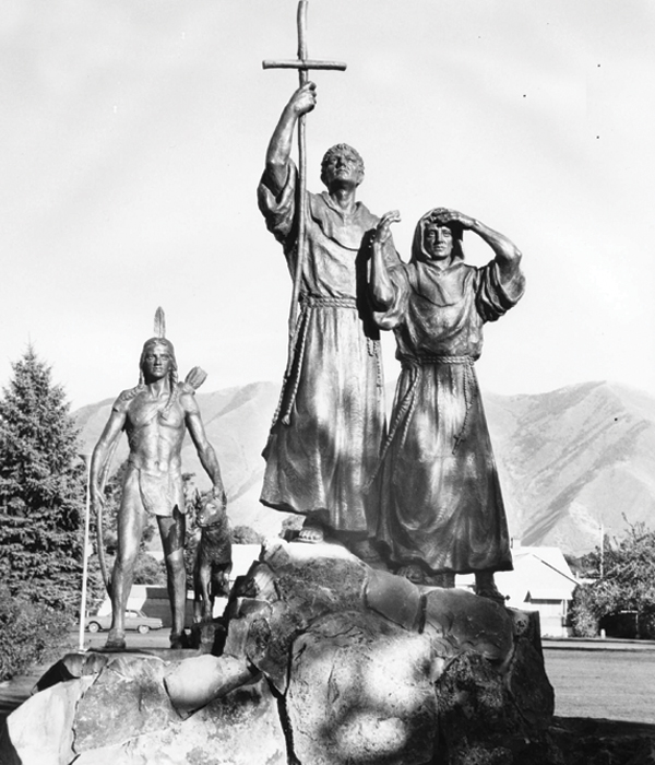
A bronze monument honoring Padres Dominguez and Escalante, located in Spanish Fork, was created by Avard T. Fairbanks
The next day, as we headed east on Colorado Highway 184, we stopped at the Canyons of the Ancients National Monument Visitor Center and Museum (27501 Highway 184, Dolores, Colo., 970-882-5600, BLM.gov). This interpretive center gives visitors a comprehensive understanding of the area’s archeological history that you’ll appreciate when you visit nearby ruins and archeological sites.
The nearby San Juan Mountain Range is absolutely breathtaking, and the sleet that fell on us as we walked the charming streets of Telluride (65 miles north of Dolores off Colorado State Highway 145) only freshened the atmosphere for our next stop in Ouray (reached by taking Highway 145 north to Placerville, then heading east on State Highway 62 to Ridgway, then south on U.S. Route 550).
Let me say this: I. Love. Ouray. There’s a reason they call it the Switzerland of America. It’s breathtaking. We stayed at the clean and relatively new Ouray RV Park and Cabins (1700 N. Main St., Ouray, Colo., 970-325-4523, OurayRVPark.com) located close to the Ouray Hot Springs Park. This campground is what we call “parking lot” style RV camping, with few trees and no privacy barriers between campsites. But, with full hookups and laundry facilities, it worked well for one night.
Another option is Ridgway State Park (28555 Highway 550, Ridgway, Colo., 1-800-244-5613, CPWShop.com), about 10 miles north of Ouray. Activities there include boating on Ridgway Reservoir and hiking an extensive trail system in all three areas of the park, including Dallas Creek, Dutch Charlie and Pa-co-chu-puk. The Dutch Charlie area has two campgrounds: Elk Ridge, with canopies over its picnic tables, and the Dakota Terraces campground. Both have electric hookups, washers and dryers, showers, vending machines and nice playgrounds.
En route to Dominguez-Escalante National Conservation Area, we diverted from U.S. Route 550 (via U.S. Route 50, then Colorado State Highway 347) to the Black Canyon of the Gunnison National Park (South Rim Visitor Center is 7 miles north on CO-347 from the intersection with U.S. Highway 50, 970-641-2337, NPS.gov/blca). This craggy, seemingly bottomless black rock canyon was cut by the Gunnison River and is distinct from the red rock parks that dominate the region. It’s a “must-do” if you are traveling in this area. The South Rim campground has three loops, with loop B being the one we’d use because it has electrical hookups.
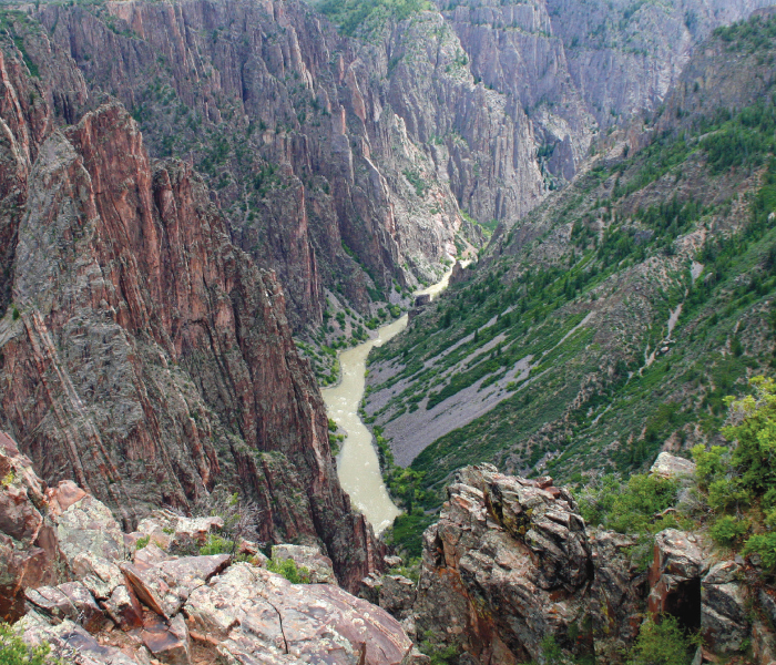
Gunnison River running through the Black Canyon of Gunnison National Park
The efforts of the Dominguez-Escalante expedition were primarily focused on finding a trade route across the unexplored continental interior from Santa Fe, N.M., to the Californian territorial missions. The routes set the stage for the Old Spanish Trail trade routes used during the 1800s by traders of all goods and nationalities. To learn more, visit the Old Fort Uncompahgre Interpretive Center (440 N. Palmer St., Delta, Colo., 970-874-8349, FortUncompahgre.org). Maintained by the Old Spanish Trail Association, the fort is a replica of the original and worth a visit, especially if you’re traveling with kids.
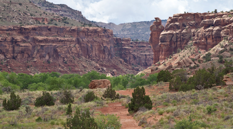
To see a real red-rock gem, visit the Dominguez-Escalante National Conservation Area (970-244-3000, BLM.gov/programs/national-conservation-lands/colorado/dominguez-escalante-nca). We drove to the Potholes Recreation Site (from Delta, Colo., travel north on U.S. Route 50 and take the turnoff to Escalante Canyon Road, which then becomes Escalante Creek Road), located 12 miles up Escalante Canyon. With pit toilets and no utilities, the campground is beautiful, primitive and remote. Here, you’ll find climbing walls and, for serious kayakers, whitewater options on Escalante Creek and Gunnison River. Getting here, expect a few hairpin turns on a maintained gravel road; best not to take anything larger than a Class C RV. The road threads through private ranchland, so watch for roaming cattle. With only five campsites, you’ll likely be searching for a place to boondock. We recommend camping in nearby Grand Junction or Delta and then exploring this NCA in a separate passenger vehicle if you’ve towed one.
In Grand Junction area, just north of Colorado National Monument (another great place to visit), consider camping in the Fruita section of James M. Robb Colorado River State Park (1/2 mile south of Exit 19 off Interstate 70, Fruita, Colo., 1-800-678-2267, CPW. State.Co.us) or Highline Lake State Park (1800 11.8 Road, Loma, Exit 15 off Interstate 70, 800-678-2267, CPWShop.com). FYI, Colorado Parks and Wildlife now requires advance campground reservations either by phone or at CPWShop.com/campinghome.page
It almost defies belief to imagine how the Dominguez-Escalante expedition was able to map these gorgeous areas, but I’m sure glad they did.
See you at the campground!

